Itinerary-dependent start
Camp → upper valley
The amount already climbed on Day 1 depends on the assigned camp. A higher first camp reduces the next morning’s ascent but does not remove the altitude.
The Classic Inca Trail’s highest point
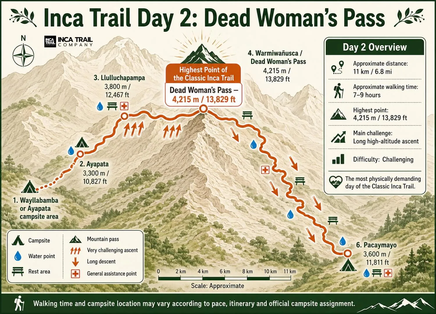
Warmi Wañusqa reaches 4,215 meters. The challenge is not technical climbing—it is sustained ascent, thin air and a steep descent that begins after the summit photo.

Hard, high and non-technical.
The pass is a natural mountain crossing on the regulated Classic route—not an archaeological ruin or a separate attraction. Most hikers reach it on Day 2 after climbing from the upper valley.
The useful mental model is simple: settle into a pace you can sustain, keep enough energy for the descent and report symptoms instead of treating them as weakness.
Follow the Day 2 sequenceQuick reference
Elevation is shown as the marked route figure. Walking hours and elevation gain depend on the first-night camp, so they are not presented as universal facts.
Name and pronunciation
Warmi Wañusqa is commonly written Warmiwañusqa, Warmiwañusca or Warmiwañuska. English-language itineraries usually call it Dead Woman’s Pass.
A practical approximation is war-mee wan-YOOS-kah, but Quechua pronunciation and spelling vary. Listen to your local guide rather than treating an English phonetic guide as authoritative.
The ascent in four stages
You do not leave camp and confront one continuous wall. Vegetation, exposure, breathing and gradient change as the trail rises.
Itinerary-dependent start
Final major reference point
Above 4,000 m
4,215 m / 13,829 ft
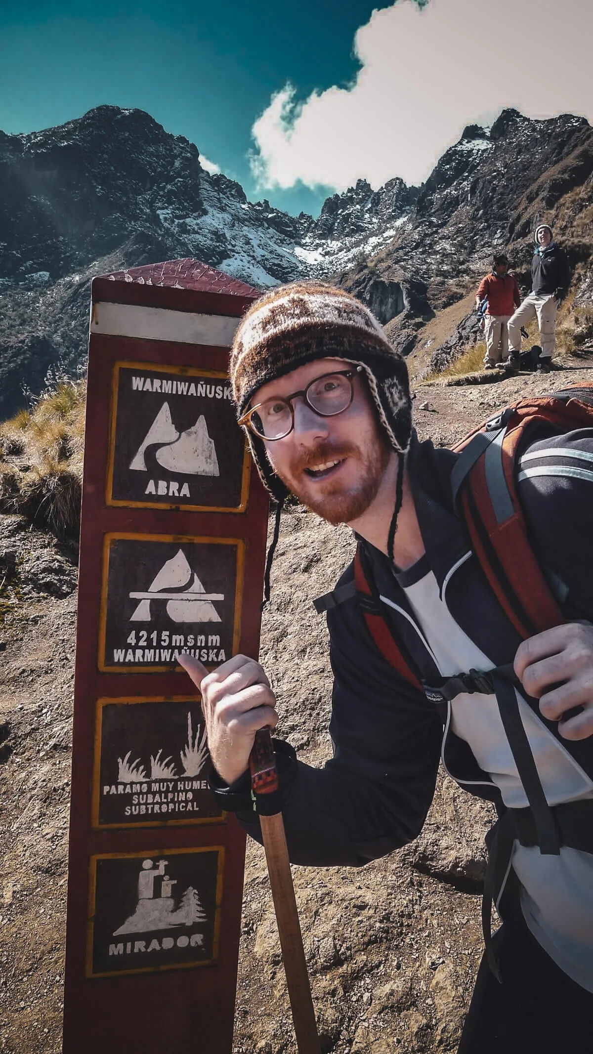
Field note from our Cusco-based team
“The pass rarely feels like one dramatic test. It is a series of smaller decisions: shorten the stride, stop chasing another person’s pace, add a layer before getting cold and remember that the trail continues downhill.”
This is collective editorial guidance from experience around trekking operations—not a promise that every traveler will feel the same.
Why it feels difficult
Training changes how prepared your legs and cardiovascular system are. It does not eliminate the physiological effect of elevation.
There is no technical move to defeat. The challenge accumulates through continuous uphill walking.
Even acclimatized hikers cannot expect the same maximum performance they have at sea level.
Step height and footing vary, so the trail does not behave like a smooth gym staircase.
Reaching the marker completes the highest climb, not necessarily the hiking day.
The summit is not the finish line
The route drops toward Paqaymayu on steep, irregular steps. Breathing often feels easier as elevation falls, while quadriceps, knees and balance take more of the load.
Some schedules stop around Paqaymayu; others continue toward the Runkurakay sector and another pass. Read the actual itinerary before assuming the famous marker ends the day.
Altitude is not a fitness verdict
Breathing harder while climbing at 4,215 meters is expected. Altitude illness requires attention to symptoms and their progression. CDC guidance says physical fitness does not determine susceptibility.
Accessible—not in the duffel
Porter arrangements vary. Your larger bag may not be accessible between camp and the next logistics point, so the pass-day essentials belong in your daypack.
Open the complete packing listCan you skip the pass?
The standard multi-day corridor crosses Warmi Wañusqa. It is not an optional side trip that can be removed after starting.
Review the complete Classic itinerary →The Short Trail starts near Km 104, reaches Wiñay Wayna and Intipunku, and does not cross the high pass.
Compare Short and Classic →What comes after the mountain crossing
Warmi Wañusqa is a natural landmark. Runkurakay, Sayaqmarka, Qonchamarka and later sites belong to the built cultural landscape that unfolds after the high-pass section.
Follow the archaeological sequenceRegulated access
SERNANP states that entry to the Inca Trail Network occurs through authorized travel and tourism agencies. Check Classic Trail inventory for the departure date, then verify the complete itinerary and campsite plan with the operator.
Understand permit availabilityPlease wait while we check the selected date.
Dates in the same month currently showing permits
Availability data may be delayed. It does not guarantee a permit, tour departure or confirmed booking.
Direct answers
Route timings vary. The pass location and route distinction do not.
The elevation shown on the pass marker is 4,215 meters, or 13,829 feet. It is the highest point on the commonly trekked Classic Inca Trail.
The widely repeated explanation says the mountain outline resembles a woman lying down. We treat that as a traditional interpretation, not a documented account of a death or a proven historical naming event.
Most four-day Classic itineraries cross Warmi Wañusqa on Day 2. The starting camp and what follows the descent vary by itinerary and campsite assignment.
There is no universal time because groups begin from different camps and respond differently to elevation. Treat any quoted hour range as itinerary-specific, not a performance target.
No ropes, harnesses or mountaineering technique are normally required. It is still a demanding high-altitude hike over steep, uneven terrain.
No. The Short Trail starts farther along the network near Km 104 and avoids Warmi Wañusqa entirely.
No. The pass lies inside the regulated Inca Trail network. Access is part of an authorized trekking itinerary, not a separate walk-up attraction.
The ascent usually creates the greater cardiovascular demand. The steep stone descent can be harder for knees, quadriceps and balance, especially when wet.
No. Fitness helps with the workload, but CDC guidance says it does not determine susceptibility to altitude illness. Acclimatization and early symptom reporting are separate safety issues.
Official sources establish the regulated route, access system and current 2026 network condition. CDC owns the medical guidance. The name-origin explanation remains labeled as tradition because a primary historical record was not established.
Prepare for both sides