
Useful numbers, missing context restored
Inca Trail facts
Thirty verified facts about distance, height, history, archaeology and regulated access—with popular shortcuts corrected.
A number without its route, date or definition can be technically true and still mislead a traveler.
Facts should resolve planning questions
This page separates the official corridor from commercial walking totals, regulatory user capacity from live traveler inventory, and historical evidence from attractive stories.
For full explanations, follow the linked specialist guides. This page is the concise reference.
Start with the essentialsAt a glance
Twelve planning facts
Distances are route-specific. Closure and capacity statements are dated because access rules can change.
- 01Location
- Cusco region, Peru
- 02Classic trailhead
- Piscacucho · Km 82
- 03Official Classic corridor
- 33.7 km
- 04Typical commercial format
- 4 days / 3 nights
- 05Classic high point
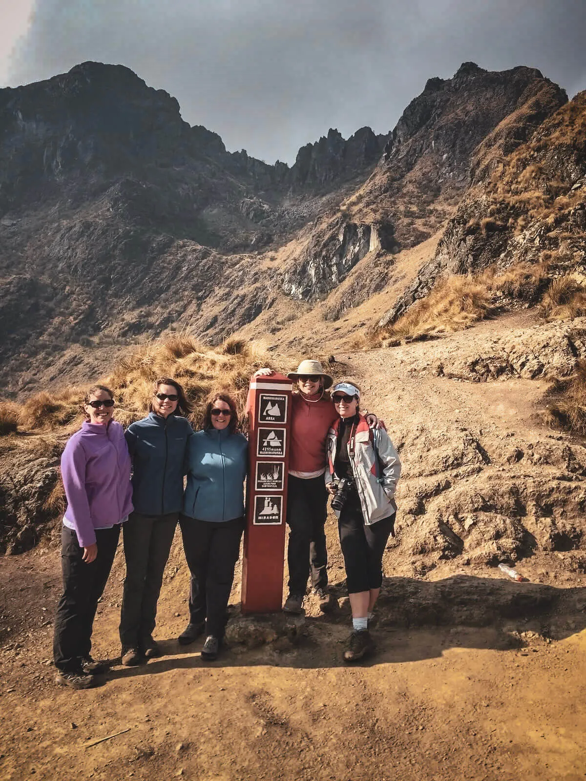
- Approx. 4,215 m
- 06High pass
- Warmi Wañusqa
- 07Short Trail access
- Chachabamba · Km 104
- 08Official Short route
- Approx. 10.5 km
- 09Independent access
- Not permitted
- 10Famous approach
- Intipunku · Sun Gate
- 11February 2026
- Closed for maintenance
- 12March 1, 2026
- Network reopened
Why two distance figures circulate
33.7 km official corridor ≠ every commercial walked total
SERNANP's visitor information lists 33.7 km for the principal Piscacucho–Machu Picchu route. Guides and operators frequently publish totals around 40–43 km.
Those figures can include different start/end points, camp movements, GPS behavior or measurement methods. The responsible answer is to label the methodology—not declare one unexplained number universally exact.
See the distance methodologyFacts 01–06
History without the tourism mythology
The historical page owns the full narrative. These are the six distinctions worth retaining.
The Inca Trail was never the empire's only road
The modern trek is one historic corridor inside a much larger Andean road tradition.
The Qhapaq Ñan exceeded 30,000 km
UNESCO describes a continental communication, trade and defense network across six present-day countries.
Some infrastructure predates Inca rule
The Inca state incorporated earlier Andean routes and expanded the system to its greatest extent in the 15th century.
One exclusive purpose is not proven
The wider network served state movement and organization; the Machu Picchu approach also supports ceremonial interpretations.
The modern trek is not a tourism replica
Hikers use genuine historic paving, stairs and sites, while controls, camps and visitor services are modern management layers.
Local knowledge came before 1911 publicity
Melchor Arteaga helped guide Hiram Bingham toward Machu Picchu; “brought to international attention” is more accurate than “discovered.”
Facts 07–10
The Classic route is an archaeological progression
Km 82 is the traditional Classic start
Piscacucho is identified by current cultural-authority reporting as the traditional starting sector for the best-known multi-day route.
Open the Classic guide →The Classic Trail is normally sold as four days
Four days and three camping nights are the standard structure, but camp assignments and actual daily distances vary.
Understand variable camps →Machu Picchu is not the only archaeological site
Patallaqta, Runkurakay, Sayaqmarka, Phuyupatamarka, Wiñay Wayna and Intipunku create an archaeological sequence before the final site.
Explore the archaeological sites →Intipunku does not guarantee a clear sunrise view
The road approaches through the Sun Gate, but cloud, mist, timing and operating conditions determine what is visible.
Compare seasonal trade-offs →Facts 11–15
Altitude and stairs change the meaning of distance
These physical facts belong to the Classic route. Do not apply its high point automatically to the Short Trail.
Review the full difficultyThe highest point is not Machu Picchu
Warmi Wañusqa reaches approximately 4,215 m; Machu Picchu sits much lower.
Distance does not describe the effort
High elevation, sustained climbs, stone steps and repeated descents make the route harder than a flat walk of similar length.
Going down can be as decisive as climbing
Long irregular stairways demand balance, controlled movement and downhill preparation.
Fitness does not predict altitude illness
Training improves trekking capacity, but CDC states that physical fitness does not determine susceptibility to altitude illness.
No official universal step total was found
Precise viral numbers should not be repeated without a credible survey. The useful fact is that extensive stone stairs shape difficulty.

Facts 16–20
Access is a chain—not a ticket you improvise at the gate
- 16
The regulated network is not open to unrestricted independent hiking.
- 17
An authorized agency, registered guide and correctly recorded traveler form part of access.
- 18
Inca Trail access and the applicable Machu Picchu visit arrangement are related but distinct inventory.
- 19
Names, dates and identity documents must match the reservation requirements.
- 20
Live inventory—not an old sell-out rule—answers whether your exact route/date remains available.
Current regulation · Facts 21–23
The old “500 permits” line is incomplete
Ministerial Resolution 294-2025-MC sets capacity in users per day. It does not say that every user position becomes one traveler space visible for sale.
Facts 24–28
The Short Inca Trail needs its own facts
Using “the Inca Trail” without a route name causes mistakes in distance, high point, duration and availability.
Different trailhead
The Short Trail enters at Chachabamba around Km 104 rather than Piscacucho at Km 82.
Different altitude profile
It does not cross Warmi Wañusqa or repeat the Classic route's high mountain passes.
Different time commitment
The official route is one principal hiking day; commercial packages are commonly arranged as one-day or two-day trips.
Shared final corridor
It includes Chachabamba, Wiñay Wayna, Intipunku and the approach toward Machu Picchu.
Separate availability
A date can show space for one route and not the other. “Inca Trail available” is incomplete without the route name.
Cloud at the Sun Gate is normal
Cloud forest visibility changes quickly. An obscured first view is not a failed trek or evidence that the itinerary was wrong.
February 2026 was conservation work—not abandonment
The Ministry of Culture closed the network during February for maintenance and reopened it March 1 after work on structures, drainage and access. Verify future years separately.
Precision check
Six claims to stop repeating without context
The correction is usually more useful for planning than the viral version.
“The Classic Trail is exactly 42 km.”
No single measurement explains every itinerary. SERNANP lists the official corridor at 33.7 km; commercial totals can be higher when access, camp movement or mapping choices differ.
“There are 500 tourist permits every day.”
The current regulation states user capacity by route. Users can include more than paying trekkers, and regulatory capacity is not the same as live saleable availability.
“Machu Picchu is the highest point.”
Warmi Wañusqa is roughly 1,770 m higher than Machu Picchu.
“You can enter when permits look sold out and hire a guide there.”
The protected network is not walk-up independent access. The authorized booking chain is part of entry.
“Short means easy.”
The Short Trail removes multi-day passes and camping, but it remains an approximately 10.5 km mountain hike with sustained ascent and stone stairs.
“Sun Gate means guaranteed sunrise.”
Intipunku describes the gateway and approach, not a weather guarantee or fixed photographic outcome.
The only fact that changes for every date
Is your route available?
Check Classic and Short Trail calendars separately. The result is an inventory signal—not a confirmed operator booking or a substitute for verifying the complete Machu Picchu arrangement.
Understand permit availability Permit checker
Find a departure
Checking availability
Please wait while we check the selected date.
Nearby options
Dates in the same month currently showing permits
Availability data may be delayed. It does not guarantee a permit, tour departure or confirmed booking.
Quick answers
Inca Trail fact FAQs
When a fact depends on route or year, the answer says so.
How long is the Classic Inca Trail?
SERNANP lists the official principal route at 33.7 km. Commercial walked totals are often described as roughly 40–43 km because starting points, camps, included movements and measurement methods differ.
What is the highest point?
Warmi Wañusqa, commonly called Dead Woman's Pass, is approximately 4,215 m above sea level.
How many days does it take?
The standard Classic itinerary is four days and three camping nights. The Short route has one principal hiking day and is commonly packaged as a one-day or two-day trip.
Can I hike without a guide?
No. The regulated routes to Machu Picchu require access through the authorized tourism system; they are not unrestricted independent paths.
How many permits are available?
Current regulation sets daily user capacities of 500 for Routes 01–04, 250 for Route 05 and 100 for Route 06. That is not the same as the number of traveler spaces shown in live inventory.
Does the Inca Trail close every February?
The network closed during February 2026 for maintenance and reopened March 1. Travelers should verify the official calendar for their own year rather than treating an old article as permanent notice.
What is the difference between Classic and Short?
They have different starts, distance, altitude profiles, durations and availability. The Short Trail joins much later near Km 104 and does not cross Warmi Wañusqa.
How many stone steps are there?
We found no authoritative official total. Exact numbers repeated online should not be presented as fact without a credible survey.
Did Hiram Bingham discover Machu Picchu?
Local residents knew the site and helped Bingham reach it in 1911. His expeditions documented and publicized Machu Picchu internationally.
Sources and update standard
Stable historical and geographic facts use official heritage sources. Access, capacity and closure claims use dated Peruvian government records.
Regulations can change after review. The date is visible so readers can distinguish current facts from permanent ones.
- SERNANP — official route descriptions and distances
- Ministerio de Cultura — RM 294-2025-MC user capacities
- Ministerio de Cultura — March 2026 reopening
- UNESCO — Qhapaq Ñan, Andean Road System
- UNESCO — Historic Sanctuary of Machu Picchu
- CDC Yellow Book — fitness and altitude illness
Reviewed August 9, 2026 · Corrections: contact our editorial team
Keep the route name attached to the number
Then use the fact to make a better decision
Compare the right trail, prepare for its real demand and check the exact date.